Walks Pages
... ISLE OF WIGHT ...
NITON - BEMBRIDGE
via the Yar River Trail

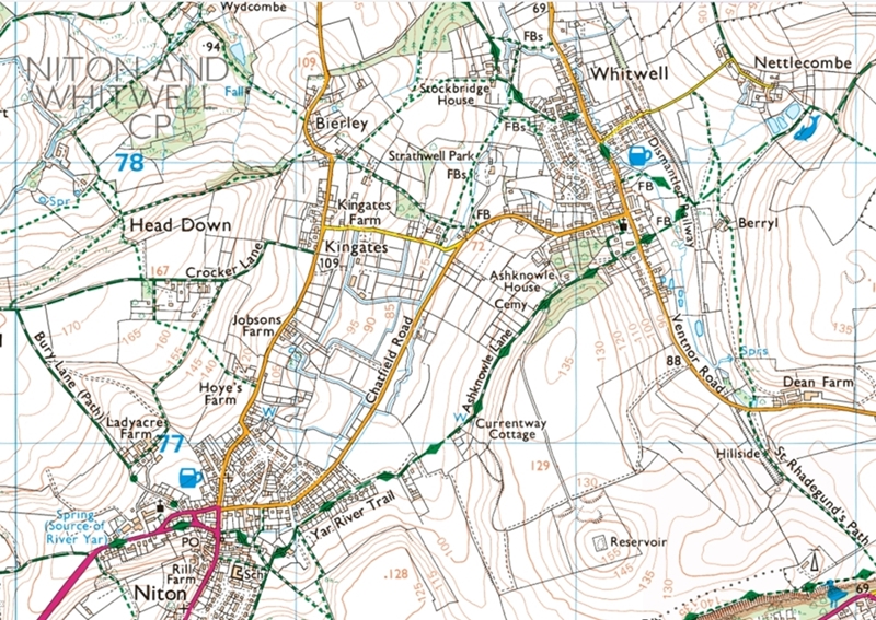
Niton to Whitwell
Whitwell to Godshill
Godshill to Newchurch
Newchurch to Sandown
Sandown to Brading
Brading to Bembridge
Section 1 : Niton to Whitwell
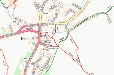 |
From the River Yar source marker stone, head east along Blackgang Road.
The road merges into High Street and, where it joins Institute Hill, cross over and take Public Footpath NT23
The path runs as an alley between houses and on reaching a junction in the path, turn right onto
On reaching a five-way junction, take the left-hand path (Footpath NT20) onto Allotment Road
|
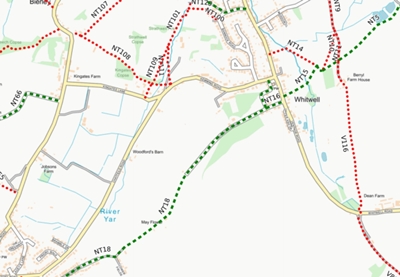 |
Pass through a field, then on reaching a small group of houses, bear left and upward through another field, continuing to the top. The track meets the driveway to a house adjacent to which is a milestone. Bear left along the drive which develops
Pass Whitwell Cemetery before descending to Ventnor Road at Whitwell village. At the road turn left, then after a short distance turn right into a grassy track (Footpath NT15) passing The Whit Well. Enter a field and continue ahead to cross a small stream. Proceed ahead upwards to reach the trackbed of the former
Come back on to High Street then turn right to follow the road northwards through the village. |
Return to the top of the page.
![]()
![]() Introduction Page
Introduction Page