Walks Pages
... ISLE OF WIGHT ...
NITON - BEMBRIDGE
via the Yar River Trail

| Distance | - | 19 miles |
| Start point | - | Blackgang Road, Niton (OS Ref. SZ504773) |
| Date walked | - | 15-18 June 2012 |
| Weather | - | Sunny spells. |
| Conditions | - | Damp but firm underfoot. |
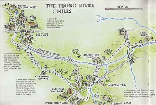
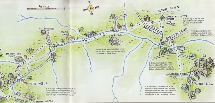
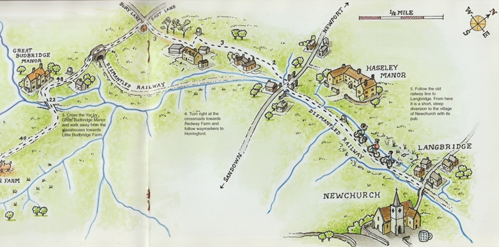
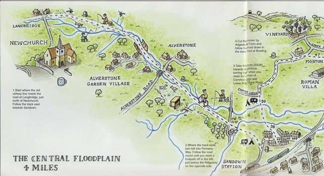
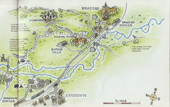
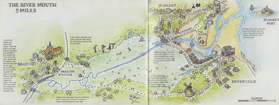
| Note | - | This walk generally follows the Eastern Yar from it's source in Niton to Bembridge where it enters the sea. |
| - | There are milestones along the route and the trail marker above is evident in some places. | |
| - | The illustations below are from the Yar River Trail booklet. Information is also available >online. | |
| - | Some of my notes from the walk have been lost. However, I have reconstructed the notes where possible | |
| taking information from the Yar River Trail booklet, Perry's Guide Maps of the Isle of Wight. | ||
| - | Invaluable online sources also used are O.S.Maps and Wight Paths. | |
| - | Another relevant source online is Isle of Wight Council Rights of Way Maps. | |
| - | Some photographs were taken along the route of the walk. |